> Cape to Cape Publishing Home
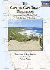
The Cape to Cape Track Guidebook: Incorporating the Meelup Trail
Fully-Revised Ninth Edition
Jane Scott & Ray Forma, with illustrations by Patricia Negus
235 x 167 mm. 112 pp. including index
Published in Paperback in December 2020: ISBN 978-0-9924851-9-1
Click on on any item in the following list of sample pages to view a .pdf file of the page spread. You need Adobe Acrobat Reader to view this file.

Table of Contents
Map page
Guide page
The Cape to Cape Walk Track is located in the far south-west corner of Western Australia, just 250 km south of Perth. It meanders along the whole length of the Leeuwin-Naturaliste Ridge, which forms the backbone of the spectacular Leeuwin Naturaliste National Park. Its start and finish are the lighthouses at the rugged tips of Cape Naturaliste and Cape Leeuwin.
The Cape to Cape Track and Meelup Trail offers:
- 123 km of stunning coastal scenery, quiet sheltered forests and pristine beaches;
- a multitude of opportunities for short, day walks of any length;
- a challenging adventure of five to seven days to complete the whole walk;
- close proximity to the caves, vineyards and host of other delights of the South West Capes – Margaret River Region.
This book offers you:
- Detailed descriptions of the Cape to Cape Walk Track, the Meelup Trail and many short walks in the Leeuwin Naturaliste National Park;
- 22 full-page 1:25 000 up-to-date maps covering all of the coast from Dunsborough to Augusta, and most of the Leeuwin Naturaliste National Park. The maps show the Cape to Cape Walk Track, The Meelup Trail, and, for the Leeuwin Naturaliste National Park, all access roads, paths, and popular surfing spots;
- Detailed distance tables;
- All recent permanent Track realignments;
- All other current navigable tracks in the National Park. Beware that in most other maps these side-tracks are dangerously out-of-date and could lead you into disater in case of emergency;
- Lots of useful information about walking in the Leeuwin Naturaliste National Park;
- 142 full-colour photographs of the area.
If you find any other corrections or updates then please let us know at capetocape@smartchat.net.au
KML & GPX files
Below are KML and GPX files you can download, or open in suitable apps. These files show, on map backgrounds, the various tracks described in this book.
Boranup lookout.kml
Cape to Cape Track.kml
Deepdene campsite.kml
Meelup trail.kml
Waterfall detour.kml
Winter bypass.kml
Boranup lookout.gpx
Cape to Cape Track.gpx
Deepdene campsite.gpx
Meelup trail.gpx
Waterfall detour.gpx
Winter bypass.gpx
Δ Ensure that you read our full Disclaimer about the information provided on this website.
Last updated on
Sunday, 13 December, 2020
> Cape to Cape Publishing Home